Should manufacturers of marine electronic cards be responsible for errors in them that lead to accidents and injuries? How to minimize the damage from poor quality cartography? The editor of SAIL magazine, Charles Doane, with more than 45,000 nautical miles in his account, knew the question.
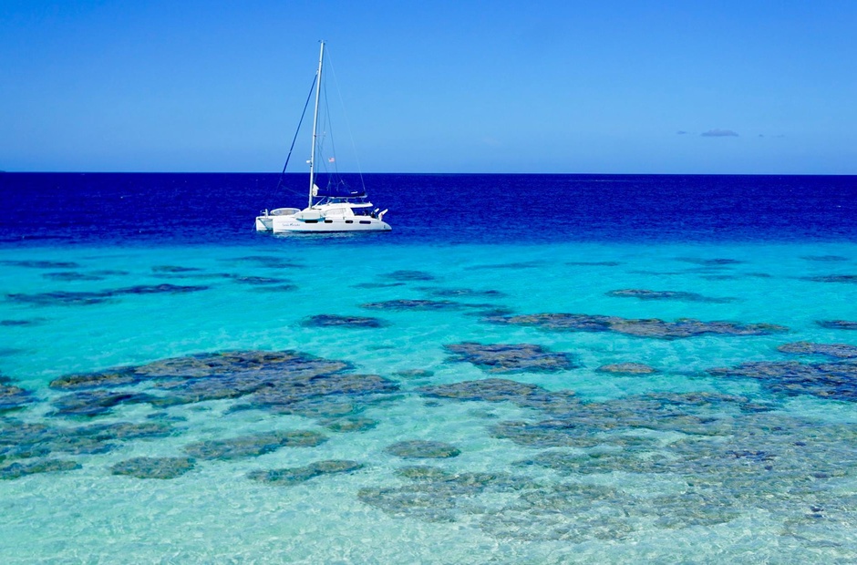
I noticed this story a few days ago and finally had time to study all the available facts. It took a certain amount of concentration, as the style of writing by Belinda Govatos, a yachtswoman and a blogger who went through all these events with her family and scrupulously recorded them on her website Adventures of a Tribe, does not include paragraphs. The story begins on the night of July 18th when, as Belinda writes, her husband Danny was on deck watch and she was cooking dinner aboard their Leopard 46 Tanda Malaika catamaran, which departed from Mourea Island in French Polynesia and was approaching Hua Hinet Atoll.
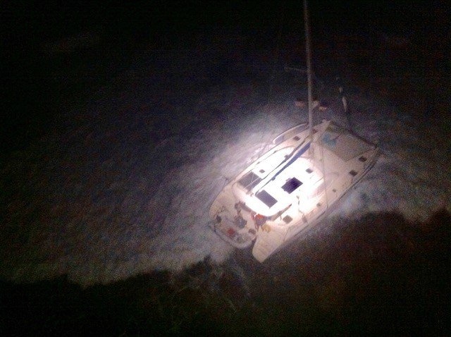
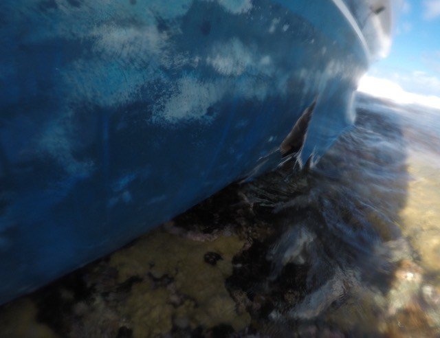
«We were walking at about 8-9 knots," she writes. - Under the stack and under both engines. Danny was watching the navigational instruments when he noticed that depth suddenly dropped from 180 feet to zero. He tried to turn the steering wheel sharply to the left, realizing that there was an unmarked reef ahead. At the same moment, we felt a strong blow».
The family was evacuated from the catamaran that night by helicopter. On the shore of Belinda, local authorities were questioned.
«When they asked us what had happened and we answered that our navigation devices did not show the reef, they specified whether we had used Navionics maps. I confirmed that.
I was led to a large wall map and asked to indicate where Tanda Malaika was. I tried to do it as accurately as possible. Then they pointed to two places where all crashes happen. One of them was a match for ours. We were given the phone number of someone we could call to save the property. To me, it sounded like the death of our boat. Did Tanda Malaika just finish her last voyage?»
Navionics representatives commented on this in comments to the post on Noonsite. They predictably reminded us of the alphabetical truths, advising us not to rely on one source of information and not to approach the reefs at night. Lectronic Latitude conducted a more in-depth study, finding that Navionics maps for the iPad are more accurate than maps for a specialized chartplotter, which looks quite perverse, I must say.
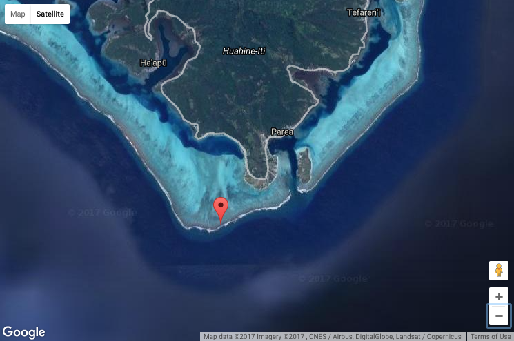
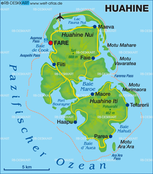
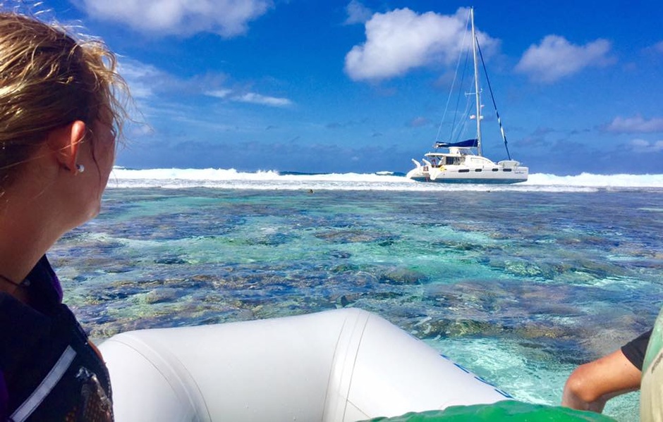
If we hammer in Google maps the Tanda Malaika's GPS coordinates for the wreck, as indicated in Belinda's blog - 16°49'47» S, 150°59'41» W - we can see that the reef on which the catamaran struck could not be ignored. It is a very important reef, completely encircling the islands that make up Hua Hiné Atoll.
Mourea, from which Tanda Malaika came, is southeast of Hua Hin. Apparently, skipper Danny tried to circumnavigate the southern tip of the reef and then headed along its western border to the local capital, the city of Faro. He thought he was at some distance from the reef, we don't know which one.
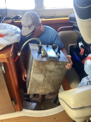

Gone are the days when you could just leave a wrecked boat on the reef. With the help of other cruisers, the crew of Tanda Malaika worked for many days to get everything valuable off the boat. Having determined that the catamaran could not be repaired, the owners had to hire a rescue team to take the boat off the reef and then sink it into deep water. The cost of this enterprise is at least $35,000.
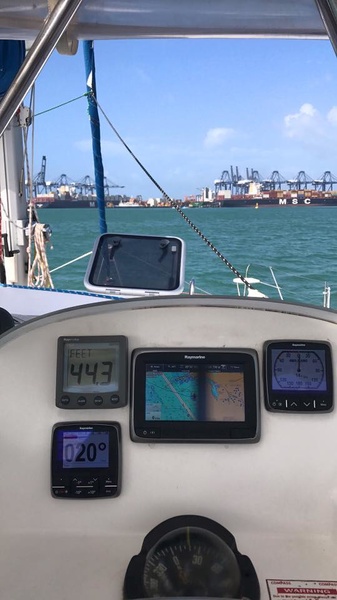
The biggest advantage of e-cards is that you can use several data sources at the same time. By comparing the maps from different manufacturers to each other, I realized how often they contradict each other and this taught me to be very careful when navigating.
When you use electronic maps, you must remember to zoom in on the areas of interest, as different types of information may disappear from the map at different scales. Remember, for example, the drama of the Vestas Wind team during the previous Volvo Ocean Race. And yes, keep in mind that all maps based on initially inaccurate location of objects will be inaccurate. Do not think that simply because satellites can determine your position, the position of reefs and other dangerous objects on your map is determined with the same accuracy.
Summary: I agree with Navionics that they cannot be blamed for this accident. However, given that this is not the first such incident, they have definitely already been informed that they have cartographic problems in this area.
Garmin, who continued to publish his maps with a purple line marking the Shore Canal, even when the government removed the line from its maps, finding it misleading, is now in court on this matter.
The skipper in that particular case was not entirely innocent. He followed the purple line on his chartplotter down the Santa Lucia Channel at 21 knots. Even when the line led him to the wrong side of the marker, he didn't think to slow down and his wife unfortunately suffered a lot when the boat ran aground at high speed. However, I would be surprised if Garmin would get out of this process without damaging himself.